
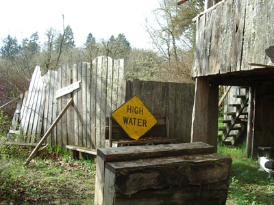
All of the OCF paths and parking lots are in the flood plain of the Long Tom River.
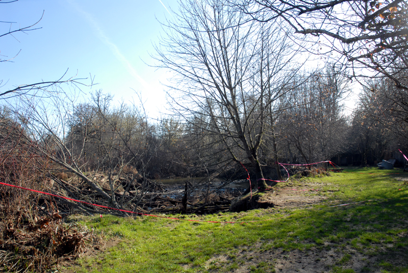
The Long Tom River is a low-gradient, meandering waterway that moves actively across its floodplain at the Oregon Country Fair. In some areas, the river bank has moved as much as 100 feet in the four decades that OCF has been on its banks. Other reaches have been remarkably stable. For example, a road crossed the site 150 years ago. The banks where the pioneers forded the river have not moved and the logs laid in the river bed as a corduroy road remain in place.
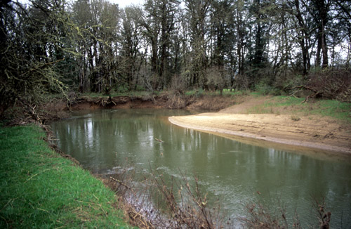
The channel width is approximately constant, around 80 feet. When the river cuts into the landscape at a cut bank on the outside of a bend, a point bar builds on the opposite bank as sediments are deposited by the slower current inside of the bend. Areas of rapid deposition show up in an aerial photograph as bright white beaches--and across from them, cut banks are eroding rapidly.
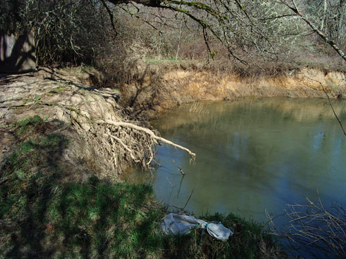
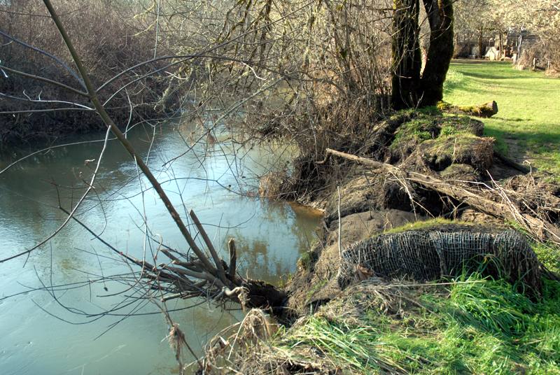
The freshly-deposited point bar on the right forms across from the active cut bank on the left. Note the exposed tree roots and undercut sod layer on the cut bank.
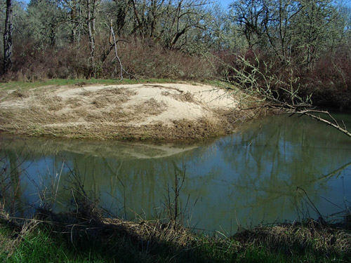
Another point bar. Within a few years, this freshly-deposited sand will be covered by brush.
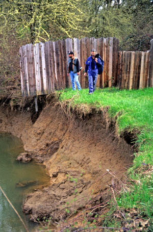
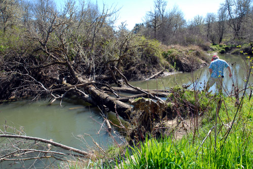
Steve and Bob examine the cut bank at Chela Mela Meadow. The channel is typically ten to twelve feet deep. The soil is young and unconsolidated, offering little resistance to erosion. Sustained efforts to plant vegetation that would control erosion have come to naught because the river concentrates its erosive force on the vertical wall of the cut bank, where no vegetation will grow. Plantings at the toe of the bank do nothing to slow erosion.
Floods deposit sediment eroded from upstream.
Roots of the Dharma Garden maple cannot stop the power of the river. The cut bank in the distance has moved more than 80 feet in the past 40 years, consuming camping spaces and a road.
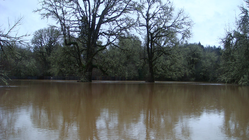
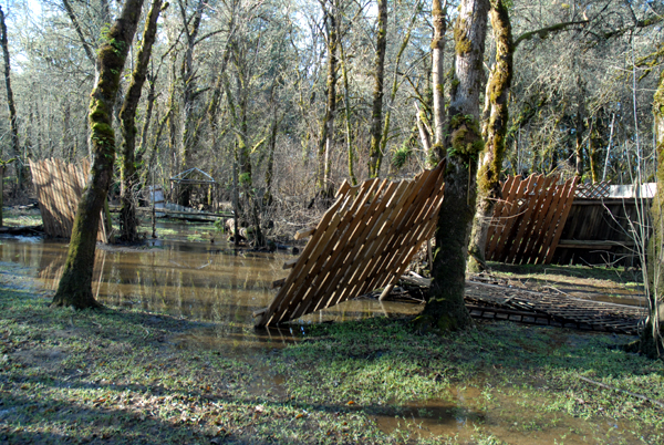
A big flood can inundate most of the paths and parking lots.
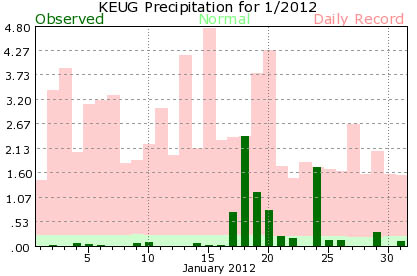
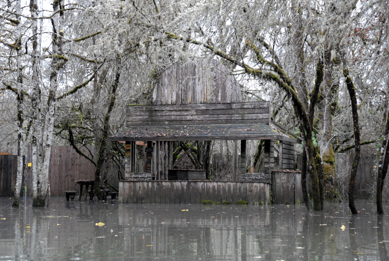
On January 18, 2012, 2.39 inches of rain fell in Eugene, setting a record for the date. The Long Tom River rose rapidly, flooding the OCF site for several days.
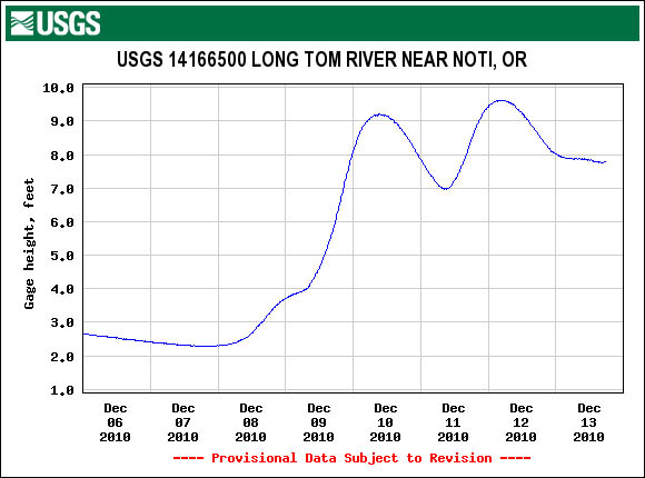
The USGS Long Tom River gage at Noti measures the river's flow. As a general guide, river heights over 10 feet indicate flooding on the site.
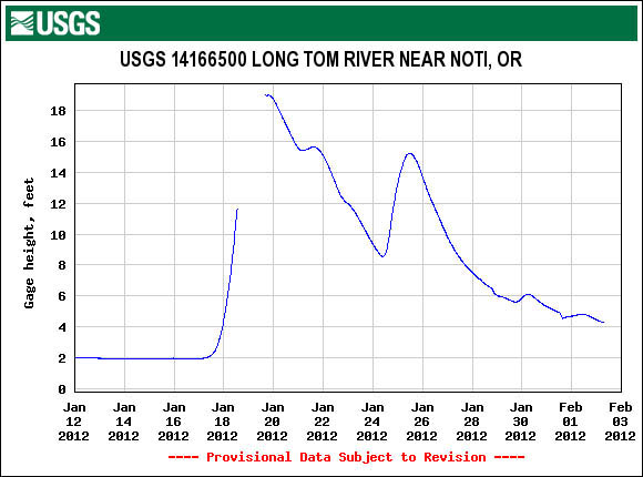
The Noti gage shows how rapidly the water rose. The gage was inoperative for a day and might have missed the peak, but showed 19.01 feet on January 19. The flow, at 5,810 cubic feet per second, was close to the record.
The maximum flow on record was on December 22, 1955, when the gage reached 20.17 feet (6,990 cubic feet per second). In the past four decades, seven floods have exceeded 18 feet:
Jan. 21, 1972: 18.93 feet
Jan. 15, 1974: 19.64 feet
Feb. 17, 1996: 19.98 feet
Nov. 19, 1996: 18.03 feet
Dec. 28, 1998: 18.62 feet
Dec. 31, 2005: 18.37 feet
Jan. 19, 2012: 19.01 feet
Note that 18 feet at the Noti gage does not mean that there will be eight feet of water on the OCF site, where the water spreads over the landscape. In this flood, the water depth in the Figure 8 was up to three feet. The parking lots were flooded almost to Maple Gate.
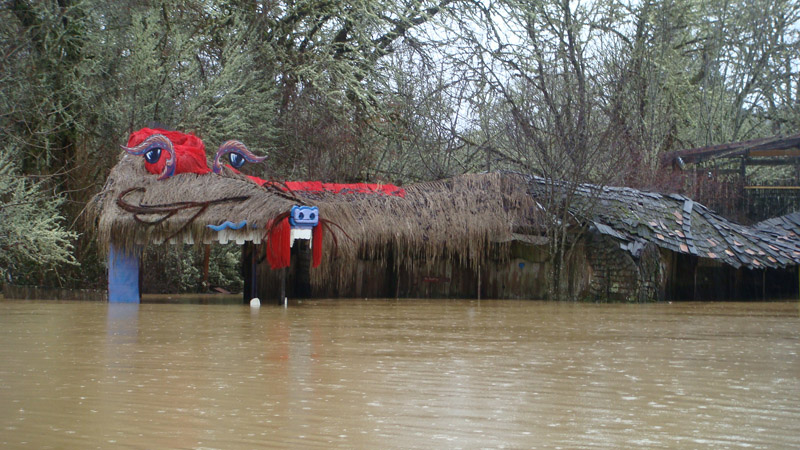
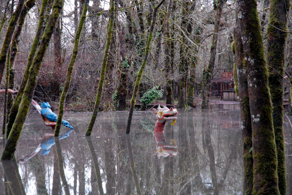
The dragon's teeth were covered on January 20, 2012.
Water ran fast down East 13th near Main Stage. (Jan. 20, 2012)
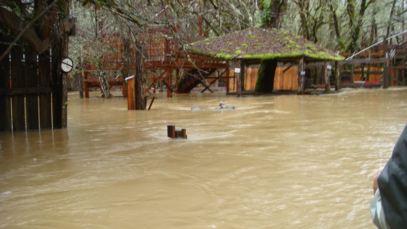
The water at the entrance to Energy Park was as deep as the top of the drinking fountain.
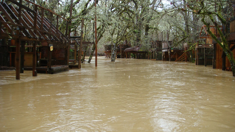
The Crafts Lot was inundated (Jan. 20, 2012)
At Child Care on Sesame Street, the lowest part of the Fair, the maximum depth was about five feet. Newly-installed fence posts and panels floated out of the ground and were pushed over by the current. (Feb. 2, 2012)
Booth parts floated down East 13th and stranded near Sesame Street. (Feb. 2, 2012)
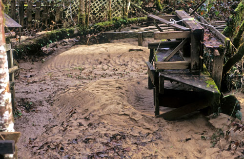
The racing flood water scoured soil from the paths. (Feb. 2, 2012)
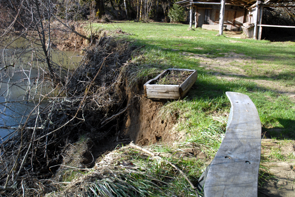
At Archaeology Park, erosion undercuts a flower box and threatens a bench. (Feb. 2, 2012)
At Strawberry Lane, an erosion hot spot consumes the path, forcing the relocation of booths. (Feb. 2, 2012)
This Strawberry Lane maple, one of the few left of many planted in the early 1990s, was undercut in December 2011 floods. The January 2012 floods toppled it into the river. Riparian trees do not stop erosion; instead, they may worsen its effects by taking great wads of soil with them as they fall. (Feb. 2, 2012)
A fallen maple becomes a beaver banquet when the water rises. (Feb. 2, 2012)
What the river takes, it gives back. Newly-deposited sediment on Strawberry Lane fills a low spot. (Feb. 2, 2012)
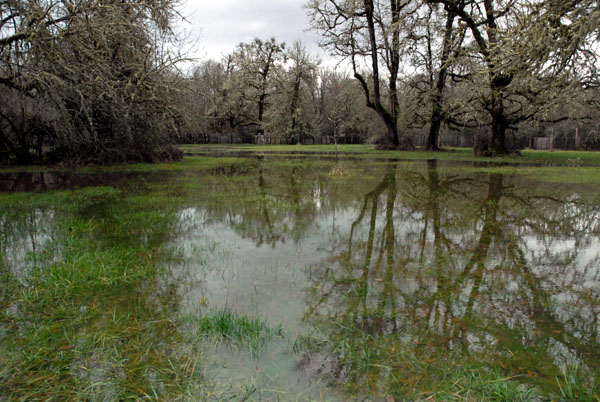
Flooding can happen even if the Long Tom River does not overtop its banks.
Dana's Cheesecake booth on December 12, 2010. The flood water came from the Indian Creek watershed--the Long Tom River did not overflow its banks.
Sesame Street is the lowest part of the Figure 8 and in the historic Indian Creek channel. It floods early and often. (December 12, 2010)
Crafts Lot (December 12, 2010)
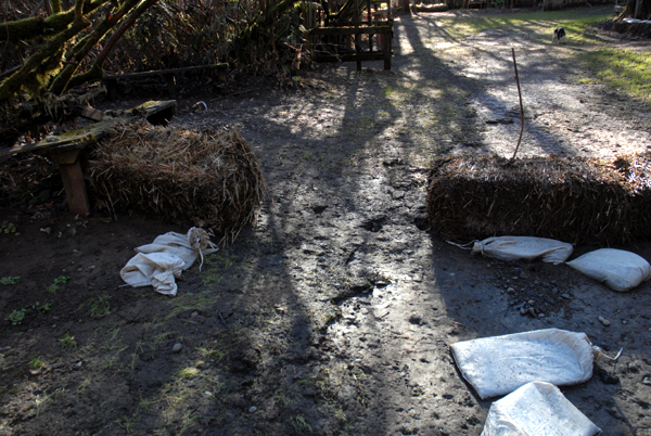
Preventive measures can reduce erosion on the paths, but bank loss continues.
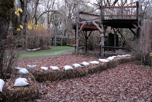
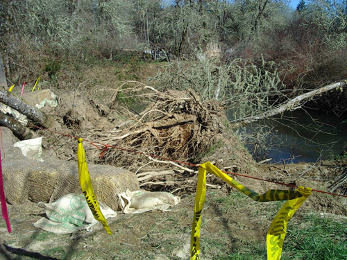
Straw bale dams, weighed down with sand bags, help slow floodwaters on the paths.
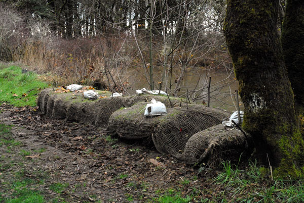
Bale dam levees, held together with biodegradable fabric, are being tested for their effectiveness in reducing scouring erosion.
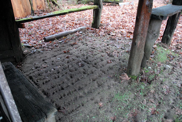
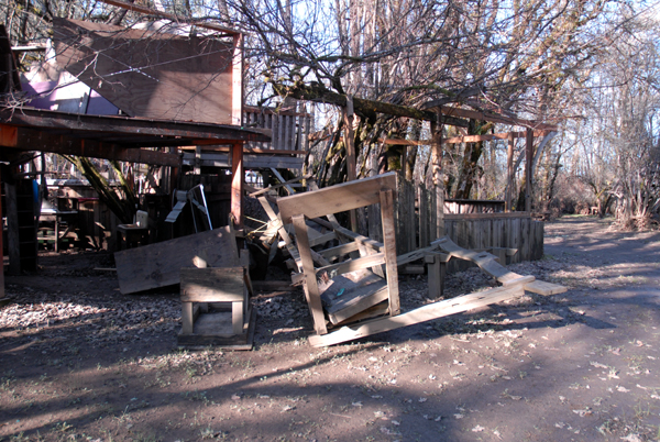
Drip erosion under a loft shows why booth construction guidelines require the removal of loft decks after the Fair.
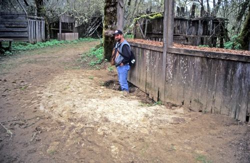
Steve stands in a scour hole that flood currents dug under a booth front. Booth construction guidelines now require removable front panels and fence panels in flood-prone areas.
The river undercuts riparian trees. A fallen maple on Strawberry Lane. (spring 2007) Federal and State laws and reverence for the land prohibit the use of hard armoring, such as rock rip-rap, to protect banks.
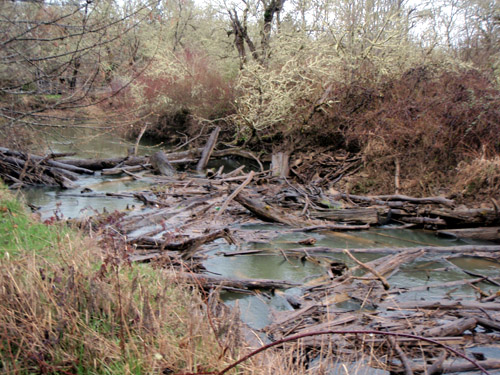
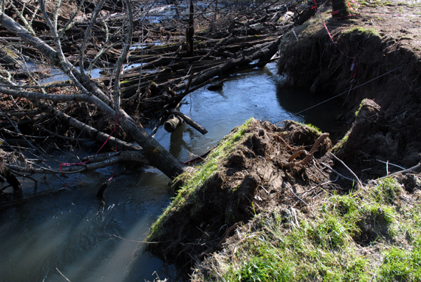
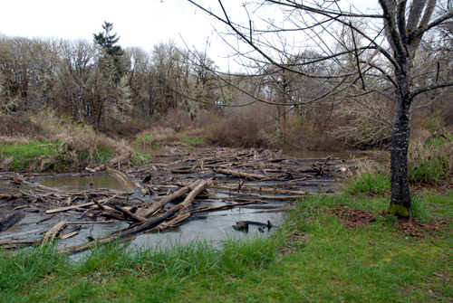
The log jam along Strawberry Lane accumulates material from upstream. The log jam provides habitat and refuge for many creatures.
Every flood rearranges the log jam. Bank slumps occur frequently at certain hot spots (see aerial photo). On the right in this March 2010 Strawberry Lane photo is a maple tree planted some 30 feet away from the river bank in the early 1990s. It began its fall into the river in December, 2011.
This tree fell along Strawberry Lane in February, 2006. Because a tree's roots are mostly in the top few feet of the soil, and the river cuts its bank ten feet down or more, riparian trees cannot provide bank stabilization.
Floods provide valuable habitat and allow aquatic creatures access to terrestrial resources.
When the river cuts a shortcut through the neck of an oxbow, the abandoned channel becomes a lake. Many of the low areas around the figure 8 are old channels.
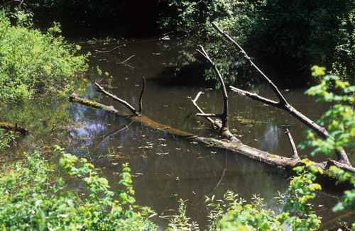
Spirit Lake is an example of an oxbow lake.
Daredevil Palace is another oxbow lake.
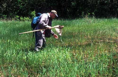
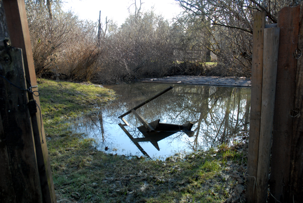
Chris, a Federal wildlife biologist, surveys aquatic life in Miss Piggy's parking lot, which stays flooded through most winters and provides a nursery for a host of creatures..
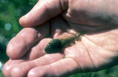
A red leg frog tadpole found in Miss Piggy's
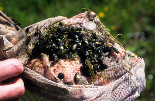
A net full of tree frog tadpoles found in Miss Piggy's. Juvenile fish, water fowl, amphibians, reptiles, and insect larvae also thrive in the flooded parking lots.
links
Long Tom Watershed Council
Long Tom River gage at Noti (USGS)
Long Tom River gage at Noti (National Weather Service)
NOAA Northwest River Forecast Center
Fair Family News river articles
The Long Tom River Squirms Like a Worm (Dec. 2010)
The Sea, the Sky, the Mountains, the River (Feb. 2011)
Path Planning Committee home page
Land Use Management and Planning (LUMP) manual
e-mail pathplanning@oregoncountryfair.org
e-mail the webmaster
Oregon Country Fair family web site
Oregon Country Fair public web site